Sustainable Forestry and FAO's Global Forest Resource Assessment...
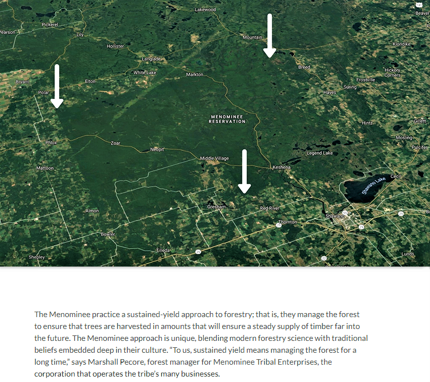
The Menominee Tribe has inhabited Northeast Wisconsin and Michigan's Upper Peninsula for generations, where ancestral tribal lands covered over 10 million acres. Following several treaties and land cessions, in 1854 the Menominee people were confined to their current Reservation lands, totaling 235,000 acres (note graphic).
The Menominee Forest has survived as an island of timber in an ocean of cleared land. It is representative of the Lake States boreal forest that existed prior to clearing for farming by settlers and timber barons (note aerial). The forest has been sustainably managed for more than 150 years and allows the Tribe to experience a traditional quality of life from an intact, diverse, productive, and healthy forest ecosystem on the reservation.
Responsible harvesting has been at the heart and the driving force for forest management on the Menominee Reservation. Currently, there is more standing saw timber volume (1.7 billion board feet) than there was in 1854 (estimated at 1.2 billion board feet). During this same period, over 2.25 billion board feet have been harvested from the same acreage (Menominee Tribal Enterprises, 2020).
FAO has been monitoring the world’s forests at 5 to 10 year intervals since 1946. The Global Forest Resources Assessments (FRA) are now produced every five years in an attempt to provide a consistent approach to describing the world’s forests and how they are changing. The Assessment is based on two primary sources of data: Country Reports prepared by National Correspondents and remote sensing that is conducted by FAO together with national focal points and regional partners. The scope of the FRA has changed regularly since the first assessment published in 1948 (FAO, 2022).
The Hand-in-Hand (HiH) Geospatial Platform is the enabling tool for the HiH Initiative unlocking over 2 million data layers for more targeted, evidence-based interventions. This Digital Public Good provides open-access geographic information, key food security indicators and agricultural statistics sourced from FAO and from external organizations such as NGOs, academia, the private sector, and space agencies (FAO, 2022).
____
https://lnkd.in/eCugQKg
https://lnkd.in/e5quP38
https://lnkd.in/gqg6bDKv
https://lnkd.in/g4NiYDrC
https://lnkd.in/gqpddiWJ
https://lnkd.in/gQGU_Vsq
